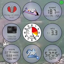
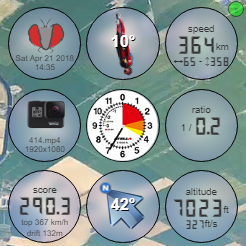
Welcome to FlySight Video !
This tool can be used to overlay your FlySight data on your jump video's. To see this tool in action, check out our demo video's.
Start by selecting a FlySight- and video file in the top left corner to begin.
You can select your local files, but nothing is uploaded to our system.
Read more...
This tool matches the end of the video to the end of the GPS file. If you shut down both devices at the same time it works flawless. Otherwise use the offset field in the right bottom corner.
The GPS data is also used to find the exit marker, so your video always starts AT the exit! And if available it tries to get scoring data for wingsuit and speedskydiving.
A FlySight in normal operation writes 5 GPS records per second, which is quite precise and does the job. However this tool uses a data interpolation model which calculates values between every frame. It also makes data sets at least useable if dataframes are missing like in the demo file.
You can save this page and use this tool offline; there's no server communication, except for the demo.
The're also a number of hotkeys like on YouTube; Up/Down=Volume, Left/Right=go 5 seconds, F="Fullscreen," Space="Play/Pause" and the 0-9 keys.

